Thursday, December 28, 2017

Geology Excursion To Tamhini Ghat And Korlai - India West Coast

On December 16 and 17, I took part in an excursion to the village of Korlai. This place is about 150 km west of Pune. The trip was organized by Deep Dive India, a venture started by my cousin Shirish Kher. The idea is to offer participants an immersive experience into one or two specialized fields.  On offer for this trip was geology and archaeology. I was the designated geology expert. The accompanying archaeologist was Sachin Joshi, a researcher from Deccan College Pune.

It was a lot of fun!

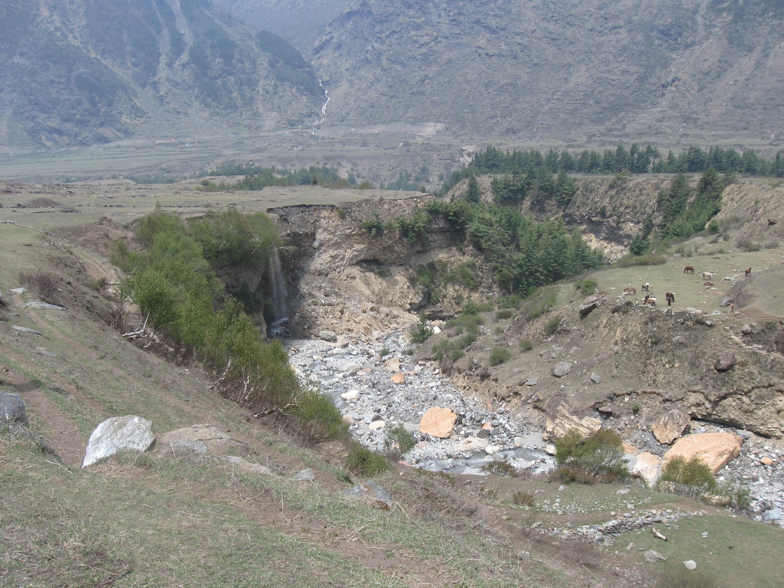
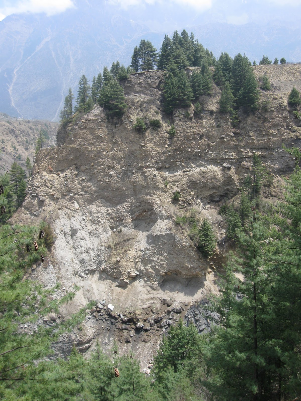
The group was mostly made up of working professionals with an interest in nature. Many of them came to know of this trip from my Twitter feed.  We drove westwards along the Deccan Plateau. Then, we descended the Western Ghat escarpment along Tamhini Ghat.  On this section, we made several stops to survey the landforms and to examine lava flows. I also gave the  group an introduction to Deccan Volcanism. After crossing the coastal plain we ended up at the village of Korlai, where there was more geology on offer.

We stayed in a home stay in the village of Chaul, a few kilometers away from Korlai.

The next day, Sachin Joshi gave us a fascinating walk-through the Portuguese forts at Korlai and Revdanda. These two villages are on opposite banks of the Kundalika estuary. It is quite a beautiful location. The forts were established by the Portuguese in the 1520's,  a couple of decades after Vasco da Gama rounded the Cape of Good Hope and established trading contacts with rulers and merchants of the Indian west coast.

The satellite image below shows the backwaters of  Mulshi and Varasgaon dams on the edge of the plateau, Tamhini Ghat, the coastal plain and the locations of Korlai and Revdanda villages. The sinuous N-S trending white dotted line seen along the Tamhini Ghat just west of the backwaters is the Western Ghat escarpment.


..and here are more pictures from our trip.

I gave a brief preview of the trip and explained the physiography of our traverse which took us along the Deccan Plateau, down the escarpment and to the coast along a broad coastal plain.


Along the way at Tamhini Ghat, I stopped to point out a lava flow contact. You can see pipe vesicles at the base of the upper flow.


 In Tamhini Ghat, unrolling a satellite imagery, I explained the landforms and structure of the Western Ghat escarpment to geology enthusiasts young and younger!


 At Korlai coast the group is looking down at a dike.


I demonstrated the use of a Brunton compass at this dike.


And here is a view of some of the many dikes intruding the basalts along the west coast.


The rampart and walls of Korlai fort along the rocky coast. You can see a cannon protruding through an opening in the wall.


The group standing on the surface of a lava flow showing columnar jointing. You can make out the polygonal shape of basalt blocks.


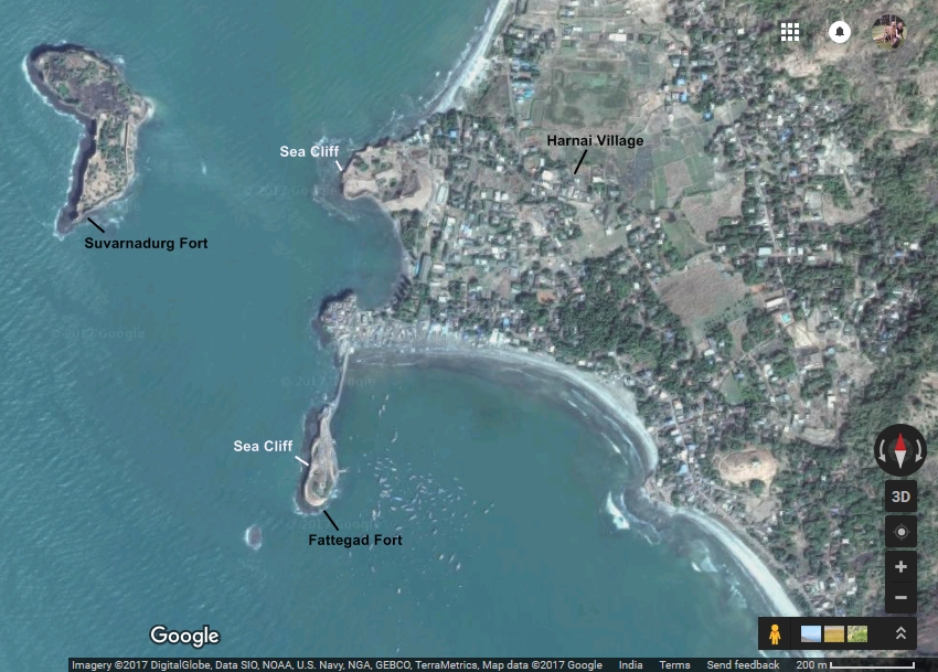
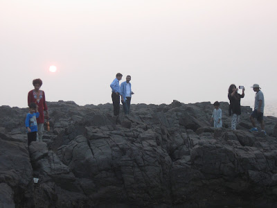
Korlai village fishing fleet moored in a back bay with the open Arabian Sea to the right. View from top of Korlai fort.


A beautiful view of Revdanda Fort, built on a sand bar, with waves crashing on to the walls and ramparts.


A watchtower in Revdanda Fort


An entrance with icons of a saint and official markings carved on stone.


 Through a broken wall of Revdanda Fort, a view of the Kunadalika estuary. Korlai Fort is on the stretch of land seen on the opposite side of the river.


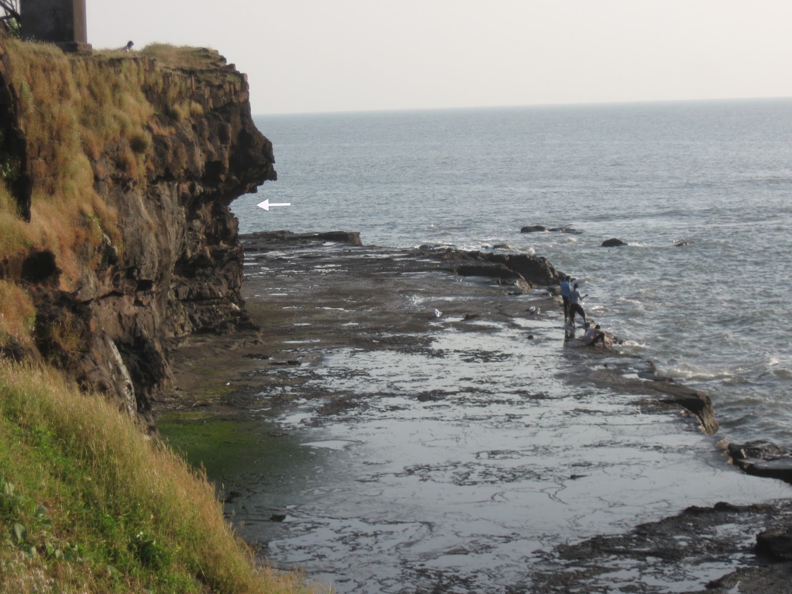
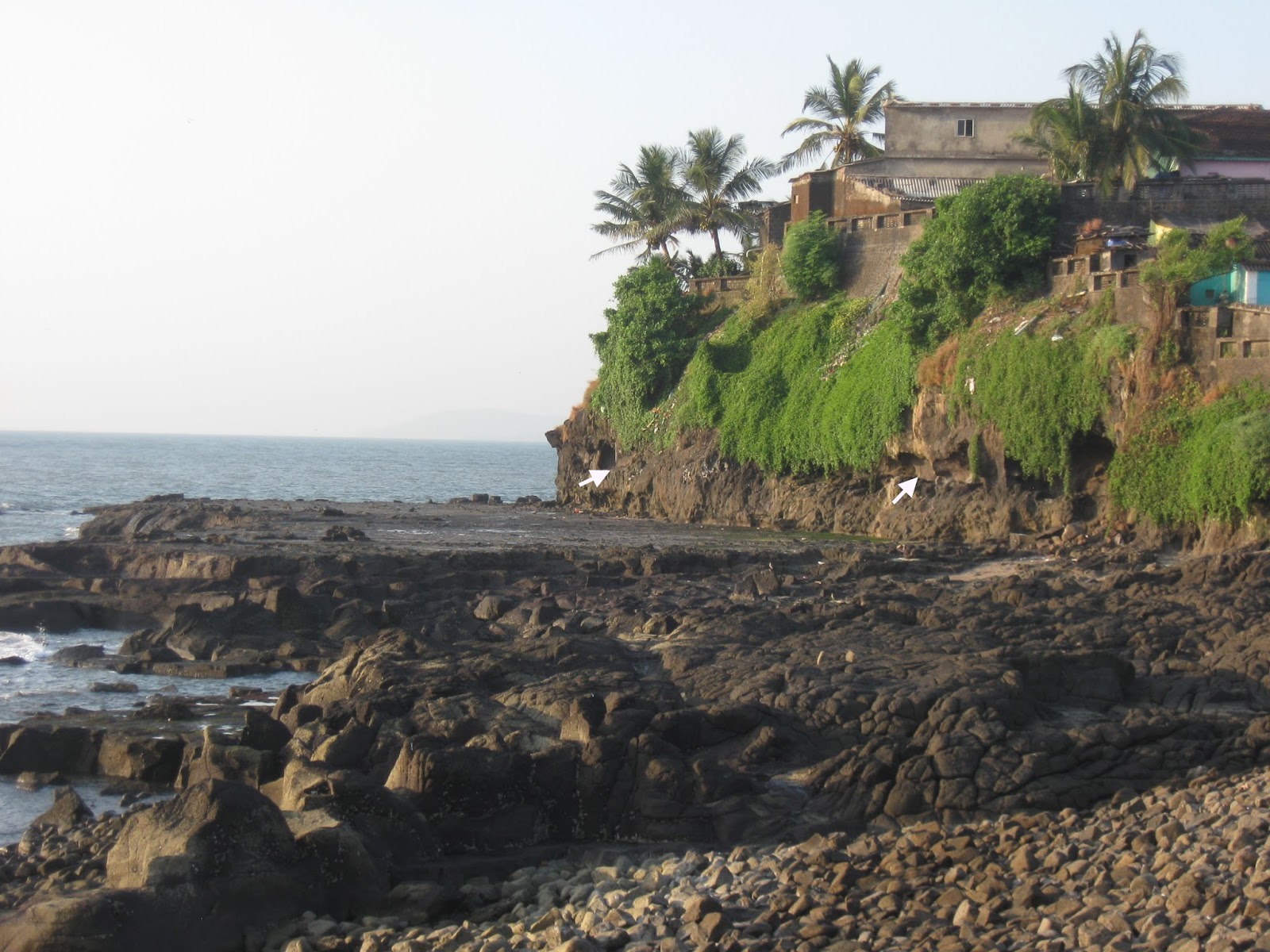
The group enjoying themselves, exploring the fractured basalts of the west coast.


A picturesque home in Revdanda village.


This was the first time I had taken a group out on an organized trip like this. I was a bit nervous to begin with. But the atmosphere was informal and the participants enthusiastic and curious. That led to many long and enjoyable discussions on geology and archaeology.

We will be doing a repeat trip along the same route in late January... more pics then.

Thursday, December 21, 2017

Lamarckism Continues To Cast A Shadow Over The Archaeological Survey Of India

A friend mentioned that she was planning to visit the famous rock shelters at Bhimbetka in Madhya Pradesh. These sandstone caves are famous for rock art and stone tools ranging in age from Paleolithic to more recent times. The site is looked after by the Archaeological Survey of India (ASI).

I remembered my own trip there over three years ago. Diving into my picture collection I  came up with this gem. This plaque was in front of a cave where Paleolithic stone tools had been found. It describes the grand story of human evolution.


Underlined in yellow is the explanation for the evolution of our dexterous hands. I am not highlighting the language but the very Lamarckian-sounding mechanism. If the claim is that hands capable of making sophisticated tools evolved just by continuous handling of stone, then this is evolution occurring through inheritance of acquired characteristics. Just like a blacksmith passing on his musculature to his children. This is not a viable mechanism of evolution. Physiological changes acquired due to a life experience are not passed on to progeny. Our gametes are sequestered from our somatic cells. I strongly suspect that a lot of people still conflate inheritance of acquired characters with natural selection.

The very first sentence "Millions of  years after Ramapithecus the species Australopethecus and its subspecies came into existence" is confusing too.  As is another plaque which shows the classic linear march of hominin evolution from a more primitive looking ape to modern humans. In it, Ramapithecus appears to be an early ancestor of humans.


Australopithecus (genus, not species), did appear millions of years after Ramapithecus, but there is no ancestor-descendant relationship between the two. Ramapithecus was initially identified as a Miocene ape and a possible ancestor of humans. Its range was the Himalaya foothills, leading to some excitement that the human family roots can be traced to the Indian subcontinent. More fossil finds have changed this early interpretation. Ramapithecus is not even considered a valid taxon anymore. The fossils named Ramapithecus are now subsumed under the genus Sivapithecus. This latter genus includes a great variety of Asian ape species. The lineage is more closely related to the ancestors of the Orangutan and not to living African apes and the hominin family.

This is just a poor show by the ASI. They need to urgently upgrade the information they are providing the public.

Wednesday, December 13, 2017

Remotely India: Structural Control On Drainage

 Remotely India #10

Check out this amazing example of fracture controlled stream flow. Follow blue arrows.


The stream originates on the steep west facing slopes of Tamhini Ghat (west of Pune) and flows a north westerly course in a NW-SE trending fracture, then makes an abrupt left turn and flows south west into a NE-SW trending fracture. It then exhibits a number of right angle turns. Finally, it turns sharply and flows north along a N-S trending fracture before joining the larger Kundalika river near Mhasewadi.

This area comprising the edge of the Deccan Volcanic Plateau and the coastal plain has been shattered by several fracture systems which formed due to tensile forces affecting the western margin of India during and post Deccan volcanism.


Take some time looking at this image above. You will see scores of small streams flowing along fractures and making sharp turns at fracture intersections. The geomorphology of this part of the Deccan Volcanic Province is a joy to explore.

Thursday, November 30, 2017

Remotely India: Folding At Margins Of The Vindhyan Sedimentary Basin

Remotely India # 9 (a post series about landforms and geological structures imaged by remote sensing satellites).

This is a geology rich image!


Source: Rajasthan Tourism

It shows Gagron Fort in the Jhalawar district of Rajasthan. I came across it while watching a history show on EPIC channel. Looking at the steeply dipping strata I identified them as the metamorphosed and deformed Aravalli Group sediments of early Proterozoic age.

I then checked a geological map and realized I had gotten the stratigraphy completely wrong. These steeply dipping rocks belong to the mid-late Proterozoic Vindhyan Group of sediments.

There are two distinct categories of Proterozoic basins in India. There are the mobile belts. An example of a mobile belt is the Aravalli orogenic belt. As the name suggests, these basins formed as linear depressions at the margins of Archaean cratonic blocks. They are filled with volcano-sedimentary successions, intruded by granitic bodies and subjected to intense deformation and metamorphism during convergence and collision between different cratonic blocks. They are economically important. Lead, zinc, copper, iron ore is mined from various mobile belts. The Aravalli belt formed due to the collision between the Aravalli craton and the Bundelkhand craton. Sedimentation in the Aravalli basin was initiated around 2 billion years ago. Their deformation and metamorphism has been dated to around 1.7-1.6 billion years ago.

The second category of basins are the epicratonic basins, developed as either rift basins or foreland basins within cratonic blocks. Volcanic activity is mostly restricted to the early stages of basin evolution. Sedimentary successions are sandstones, shale and limestone. Collectively these are known as the 'Purana' (ancient) basins. They show very light to no metamorphism and relatively gentle deformation. Flat lying strata form mesas and plateaus in the interior of such basins. The degree of deformation usually increase at the basin margins. In proximity to basin margins faults, sediments are often spectacularly folded. The Vindhyan Basin is a 'Purana' style basin.

I am putting up a few examples of folding in Vindhyan Basin sediments. These range in age from about 1.7 billion to 650 million years.

The first one is the Jhalawar anticline in proximity to the Mukundara Fault. Fort Gagron was built  on the steep NE dipping limb made up of the Kaimur sandstones.


Mukundara Fault is an easterly directed thrust fault. See this cross section across the Jhalawar anticline.


Source: Rajeev Bhoj, Avdhesh Nautiyal and Rajesh Sharma 2011:  Regional Structural Style of Chambal Valley Vindhyan Basin, Rajasthan, India

This second example of folding is south and east of the famous fort at Chittorgarh. Lower Vindhyan Group sediments have been folded into N-S trending tight anticlines and synclines. 


This folded zone abuts the Great Boundary Fault which structurally juxtaposes the Bundelkhand Craton with the Aravalli Craton. The fault brings into contact the Aravalli mobile belt and the Vindhyan 'Purana' basin. The Great Boundary Fault is a NW dipping thrust fault (ref).

Finally, northeast of the previous location, also along the Great Boundary Fault in the vicinity of the town of Bundi are these folded Upper Vindhyan sediments. These are the sandstones and limestones of the Rewa and Bhander Group.


And below is a geological map of the region to give some context to these structures. The Great Boundary Fault and the Mukundara Fault are orthogonal to each other, testimony to differently oriented compressive forces  affecting the Vindhyan Basin.


Source: Rajeev Bhoj, Avdhesh Nautiyal and Rajesh Sharma 2011:  Regional Structural Style of Chambal Valley Vindhyan Basin, Rajasthan, India

Three distinct structural trends can be seen in this part of the Vindhyan Basin. A NE-SW trend of the Great Boundary Fault. A N-S trend of the tight folds south and east of Chittorgarh. And a NW-SE  trend of the Mukundara Fault and associated folds. The other major structural trend in the Vindhyan Basin is the E-W trend of  Narmada rift fault zone which forms the southern boundary of the basin.

All satellite images from the Indian Remote Sensing satellite Cartosat series, accessible through ISRO's web mapping application Bhuvan.

Sunday, November 19, 2017

Geology And Homo Sapiens Habitats Pleistocene Indian Subcontinent

Came across an interesting passage from this review paper:

Environments and Cultural Change in the Indian Subcontinent: Implications for the Dispersal of Homo sapiens in the Late Pleistocene - by James Blinkhorn and Michael D. Petraglia

Yet beyond relief, the geological structure of the Indian subcontinent plays another important role in patterns of habitability in the region. The analysis of the structure of geological basins within the Indian subcontinent led Korisettar (2007) to the conclusion that the Purana basins exerted a strong influence on hominin dispersals and occupation history. Although direct precipitation within the Purana basins is lower than other regions of the subcontinent, perennial supplies of freshwater are available because of spring activity from aquifers that deliver water resources from regions that receivemuch higher monsoonal precipitation.As a result of reliable water resources and abundant raw materials for stone tool manufacture, these geological basins are thought to have acted as refugia not only for hominin populations but also for varied flora and fauna (Korisettar 2007).

The importance of such Purana basins for providing refugia is well exemplified by the recent study of fauna from the Billasurgum caves, located within the Cuddapah Basin. Here, excavations revealed the first stratified sequence to document patterns of faunal occupation spanning the late Middle Pleistocene to Late Pleistocene (Roberts et al. 2014). This study illustrated the long-term continuity of large-bodied fauna within South Asia with only a single taxon of twenty-four identified as having gone extinct across the subcontinent (Roberts et al. 2014).


The "Purana" basins are Proterozoic in age. They are scattered all over Peninsular India. A common lithology is silica cemented sandstone or quartzite which forms prominent hill ranges, ridges and escarpments with ledges, overhangs and caves. These hard quartzites would have been one source of raw material for stone tools.  The rocks are also fractured and networks of pervasive cracks allow the storage and movement of groundwater.

The map (from a different paper) below shows the distribution of Middle Paleolithic sites (red dots) in India, Arabia and Eastern Africa. I have outlined in black (very approximate!) the location of three Purana basins. V stands for Vindhyan, C for Cuddapah and B&K for Bhima and Kaladgi.

 Modified from Huw S. Groucutt et.al. 2015

This paper have lots of information about climate change, ecology and stone tool record found in India. The authors discuss the Late Acheulean (130k - 100 K) ,  Middle  Paleolithic (94k - 34 K) and the Late Paleolithic ( < 45 K). These terms refer to particular styles of stone tool manufacture.

The India skeletal fossil record is very poor. However, based on comparisons with Middle Paleolithic of Africa and Homo sapiens fossils and tool associations in SE Asia and Australia, the authors are in favor of a wave of  Homo sapiens migrating into India as early or perhaps a little earlier than 100 k ago. This was followed by a later wave around 50 k years ago.  Do changes in cultural style and tool use point to changing populations.. with an intrusive population replacing an earlier one?.. that is an intriguing question. Some recent genetic work suggests that people from these earlier migrations died out without leaving a genetic legacy in us. All non African humans have descended from migrants who left Africa between 50K-80K years ago.  I had summarized these results in an earlier post on human population continuity in India.

See also other papers from this special volume of Current Anthropology on Human Colonization of Asia In the Late Pleistocene

Open Access.

Friday, November 3, 2017

Field Photo: Sea Cliffs And Holocene Sea Level Highstand, India West Coast

All along India's coast there are indicators that 4000-6000 years ago sea level was higher than the present level, oscillating between 1-4 meters above present high tide level at different times. Since then, the sea has gradually receded to its present level. As a result, we can observe stranded beach ridges, cemented beach rock and dunes a few hundred meters inland of the present high tide mark. And we can see erosional notches on sea cliffs marking the past high tide level.

I saw these erosional notches in the sea cliffs exposed along the coast near Harnai village in Konkan.

The satellite image shows the location of the sea cliffs.


The picture below shows a sea cliff with an erosional notch (arrow) about 1.5 meters above the high tide level. This is at the Fattegad Fort near Harnai village. Also, notice the rocky platform that has formed at the current tidal level.


This notch can be traced all along the line of sea cliffs in the area. You can see it very clearly on this cliff, a little north of the previous location.


And the picture below shows a close up of the notch. Sea level must have held steady at this level for a few hundred years to have formed such a distinct erosional feature.


Why was sea level higher in the past? It has to do with the ice age and the end of the last glacial phase. The earth has been in the grips of an ice age for the past 2.6 million years. Conditions have cyclically fluctuated between colder glacial phases and warmer interglacial periods. During glacial phases,  growth of polar ice caps results in a sea level fall. During warmer interglacial phases, polar ice caps melt and raise sea levels. The last glacial phase lasted between 115 - 12 thousand  years ago.  During this time the sea level was as much as 100 meters lower than today. Large swaths of the continental shelf was land then. The earth then moved into a warmer interglacial phase. As a result of melting polar ice, the sea has been rising steadily for the past 10-11 thousand years, flooding the continental shelf, and culminating in a sea level highstand (maximum) about 4000-6000 years ago. This maximum was about 1-4 meters above the present sea level.

There is evidence scattered all along India's west and east coast (and all over the world) of this Holocene sea level high. For example, there are tidal flat deposits about 1 meter above present sea level along the Porbundar coast in Gujarat. Shells collected from these deposits give an age of about 4000 thousand years. Exposed reefs from Mithapur in Jamnagar district in Gujarat give an age of about 2100 years. Oyster reefs exposed along Saurashtra coast about 2 meters above present sea level are about 2500-3000 years old.

To the south, in Madh Island (Mumbai) and along Konkan coast, there are layers of hardened sand and pebbles, locally known as 'Karal', which occur 2-4 meters above present sea level. These sediments once formed a pebbly beach.  At Kelshi village in Konkan, there are fossil beach ridges a few hundred meters inland of the present high tide mark. I saw these on my recent visit. In central Kerala 4000 year old beach ridges occur 3 km inland, indicating that sea level was 3-4 meters higher then.  Along the east coast, there are 4000-6000 year old beach ridges along the Krishna-Godavari coastline. These ridges become younger towards the coast, indicating that the sea has been receding since about 4 thousand years ago.  Along the Baruva-Gandavaram coast in  Andhra Pradesh, sea cliffs have preserved a succession of erosional notches at 4.7 m, 2.3 m and 1.8 m above sea level.

All these features indicate sea level peaked about 4000-6000 thousand years ago and has been falling in fits and starts since. The exact mechanism for this sea level fall is not well understood.

Scientists have put together data form various localities to come up with a composite sea level curve for the Holocene. The curve below has been drawn up using data from Gujarat and shows sea level rising throughout early and mid Holocene. The late Holocene has seen a lowering of seas.


Source: U.B Mathur et.al. 2004

This lowering has now been reversed and the seas are rising again globally, this time induced by anthropogenic global warming as continental glaciers melt and the ocean water expands as it gets warmer. It is estimated that sea level will rise between 0.5 - 1 meter by 2100. In centuries to come, the extent of sea level rise will depend on future warming trends and the extent of melting of the Greenland and Antarctica ice sheets. If significant portions of these ice sheets melt, sea level will rise by several meters in the next few hundred to couple of thousand years.

And what about the flat rocky platforms seen in the tidal zone below the sea cliffs? How do they form? The main mechanism is cliff retreat. Waves pound at cliffs cutting a notch at the bottom of the cliff. Undercutting of the cliff eventually causes collapse of the rock face and a retreat. Over time, as the cliff retreats, a broad sea facing platform develops. This is further acted upon by weathering.  The likely process involves "water layer leveling" combined with wave erosion. Water layer leveling means the lowering and leveling of the rock surface due to physical and chemical weathering by the action of sea water. Standing pools of water and the continuous wetting and drying conditions in the intertidal zone act to weaken the rock and create a loose surface layer which is then removed by wave action, generating a flat surface.

The picture below shows a wide intertidal rocky platform from near Murud on India's west coast.


India's Konkan coast is beautiful and has interesting geology too. Do visit if you can.

References:

1) Falling Late Holocene Sea-Level Along The Indian Coast- U.B. Mathur, D.K. Pandey, Tej Bahadur 2004

2) Quaternary Sea Level Changes Along Indian Coast - S.S Mehr 1992

3) Evidence of Late Holocene shoreline progradation in the coast of Kerala, South India obtained from OSL dating of palaeo-beach ridges - Linto Alappat et.al. 2015

Sunday, October 29, 2017

The Geology Of India In 220 Tweets

Ok, I am exaggerating.

Last week I hosted the @Geoscitweeps account and tweeted 8 stories about Indian geology. This is an earth sciences focused rotating twitter account curated by science writer Sandhya Ramesh (@sandygrains).  Geologists from all over the world have been volunteering to host the account for a week and tweet about their work. I volunteered for the week beginning October 16 and decided to broadcast some interesting stories about Indian geology.  I had written blog posts about some of the topics, but it still was a challenge to create an engaging  narrative using 20-30 tweets.

Here are the threads:

1) Does India have Cambrian age Burgess Shale type fossils?

2) The Tempo of Deccan Volcanic Eruptions

3) Deccan Lava Flows and Buddhist Caves and Rock Art

4) Piggy Back Basins and Seismic Risk of Himalaya Frontal Ranges

5) Exploring India's Fossil Sites and Paleogeography using the Paleobiology Navigator

6) Which of these Indian Island Chains is Geologically Older? Lakshadweep or Andamans?

7) Evolution of the Western Ghat Escarpment and Coastal Plain.

8) How To Discover Your Inner Geologist When You Go Trekking In The Himalaya

It was really gratifying to see the enthusiastic response by readers from all over the world... and particularly satisfying to see that a large number of Indians began following @Geoscitweeps as news spread that there was Indian geology on the menu.

More Indian geologists need to start writing and talking with the general public about their work. There is certainly an audience out there eager to hear from them. 

Tuesday, October 10, 2017

#Neatrock Entry For Earth Science Week

SciFri Science Club is hosting a #Neatrock challenge as part of Earth Science Week.

Here are my two entries:

Megascopic #neatrock:


This is a migmatitic gneiss from the Greater Himalayan Sequence, Darma Valley, Kumaon Himalaya. Migmatite means a mixed rock made up of a metamorphic host and a newly formed igneous rock. During continental collision, metamorphic rocks buried to great depths and subject to high temperatures may partially melt to form granite magma. The granitic melt segregates into layers. The resultant rock is composed of the original metamorphic host rock such as a gneiss (dark bands)  and granitic igneous layers (lighter bands). This migmatite formed during the Miocene.

Microscopic #neatrock:


This photomicrograph of a Late Ordovician limestone (Fernvale Limestone) from Georgia, U.S.A.  is close to my heart. It formed an important part of my PhD work.  I have stained the thin section with a Potassium Ferricyanide dye. Calcite containing minor amounts of iron (Ferroan calcite Fe+2) is stained blue. Non Ferroan calcite is unstained.  In the center of the photomicrograph is a non ferroan 'dog tooth' spar. It is a calcite crystal with a shape resembling a canine tooth of a dog.

This calcite has a pendant habit. It is hanging from the underside of a particle, in this case a piece of an echinoid shell. Such pendant crystals precipitate in a vadose zone i.e. above the water table.  In this environment, pore spaces are not completely filled with water. Rather, films of water coat grains and form drips. These drips become saturated with calcium carbonate and calcite precipitates from them.  Just like a larger and more familiar stalactite in a cave! Except that this micro-stalactite in tiny..tiny.

Development of a vadose environment indicates that sedimentation was interrupted by a large sea level fall. The sea bed got exposed to rain and a fresh water aquifer developed in the sedimentary deposits.  A tiny 'dog tooth' spar can tell us a fair bit about sedimentary basin evolution and sea level history.

Wednesday, October 4, 2017

Geo Week 2017, Pune

 Geo-Week 2017 Pune

Starting October 9th 2017, a week long geo-activity program for the public is going to be held at Raja Ravi Varma Art Gallery, Ghole Road, Pune.

It is being organized by the Center For Education and Research in Geosciences (CERG) along with Fergusson College, Pune. CERG is a citizen outreach initiative taken by students and professionals from the Pune geology community.

Take a look at the poster.


The inaugural talk by Dr. R. Shankar of Mangalore University will be on October 9th at 11.30 am . The topic is Paleoclimate Studies of Lake Sediments from South India. The venue is Raja Ravi Varma Art Gallery.

There is another lecture scheduled on October 14th  at 7.40 pm by Dr. S. N. Rajguru. The topic is Prehistoric Environment of the Mula Mutha River, Pune. This talk will be held at the Amphitheater on Fergusson College campus.

There is also a geology exhibition, art and essay competitions for school children, earth science themed film shows and a workshop on QGIS. The exhibition is at Raja Ravi Varma Art Gallery, while most of the films will be screened at the Amphitheater, Fergusson College. Check the website for schedule details.

Pune geology and science enthusiasts, share this with your friends and do stop by and support this initiative!

Geo-Week 2017, Pune

Friday, September 29, 2017

The Bay Of Bengal Once Touched Sikkim

See this satellite imagery of the Himalaya.  The Indian State of Sikkim occupies the region just east of Darjeeling.


The Siwaliks (green arrows) appear as a forested linear band forming the southernmost hilly terrain of the Himalaya. The hills abut against broad alluvial plains. Rivers traversing the Himalaya carrying enormous sediment load encounter a gentler gradient upon exiting the hilly terrain. A loss of stream power results in sediment being dumped in the channel, so much so, that rivers get chocked on their own sediment. As a result, channels split and bifurcate forming a braided river system. These rivers  also suddenly change course, abandoning their channel and carving out new ones. Such course changes may occur during floods or by tilting of the land by structural movements.  Over time, the deposits of these ever changing rivers coalesce to form cone shape aprons of sediments known as alluvial fans. These rivers like the Kosi and the Tista, which flow transverse to the mountain range, meet an axial river like the Ganga and the Brahmaputra flowing parallel to the mountain front. The axial river flows into the Bay of Bengal.

The Siwalik hills were once these type of alluvial fans.  Just as today, during Miocene and Pliocene times, sediment was being deposited in front of the rising Himalayan mountains. Beginning about half a million years ago or so, these ancient alluvial fans were crumpled up and uplifted to form the Siwalik ranges. Active alluvial fan formation shifted southwards to its present locus. This process continues. In a few million years, the present day alluvial fans deposited by rivers like the Kosi and the Teesta will be deformed into a newer mountain range south of the Siwaliks. The Himalaya are growing southwards.

How do we know that the Siwaliks were once alluvial fans? Geologists rely on analogy, comparing the Siwalik sediments with what is accumulating in the present day alluvial fans. They find a striking similarity. Siwaliks are made up of alternations of coarse gravel layers and finer sand and silt layers with characteristic bed orientations and structures like cross beds and rippled sand. The gravel layers are inferred to be the river channel deposits while the finer sand and silt layers are the river bank, levee and floodplain deposits. An important finding made throughout the length of the Siwalik ranges has been the paleo-current directions preserved in the rocks.  Geologists have measured the orientation of bedding and ripple marks and found out that rivers were flowing south and south east i.e. perpendicular to the mountain chain. There is no evidence of an axial river like the Ganga in these Siwalik sediments. The thinking is that such an axial river must have flowed much to the south of the region of deposition of Siwalik sediments.

And what about evidence of a delta? Where did these Miocene and Pliocene rivers meet the sea? The logical geographic place to look for a coast would be towards the east. And in fact, that evidence has come from the Siwalik sediments of West Bengal and Sikkim. In a really interesting paper published recently in Current Science, Suchana Taral, Nandini Kar and Tapan Chakraborty describe sedimentary structures and marine trace fossils from Middle Siwalik sediments exposed along the Gish River and its tributaries in the Tista Valley. Siwalik rocks in the central and western part of the Himalaya show current structures that indicate south flowing rivers. In this easterly location however, the sediments show evidence of being deposited in a wave influenced environment. Sedimentary structures like wave ripple laminations and hummocky-swaley stratification indicate deposition in wave dominated marine bay.  Paleo-current indicators like ripple marks preserved on sandstone surfaces show a south as well as north directed current. This suggests an environment influenced by tides and north directed waves. Associated sediments show indicators of different delta environments like distributary channels, delta mouth bar and delta flood plain deposits.

Apart from current direction indicators, the sediments contain plant fossils indicative of mangrove vegetation and brackish water environments. They also contain trace fossils i.e. impressions and burrows made by creatures moving and disturbing the sediment surface. Cylindrichnus, Chondrites, Rosselia, Taenidium, Skolithos, Planolites are some of trace fossils reported in this study. The assemblage of trace fossils is similar to those reported from marine settings.

All this suggests that during the time of deposition of these Middle Siwalik sediments in Late Miocene-Pliocene times, about 5-10 million years ago, a branch of the Bay of Bengal had invaded as far north as present day Sikkim. Rivers carrying sediment from the Himalaya were debouching them in a delta and a shallow marine bay. The Sikkim Middle Siwalik strata are ancient deformed delta and marine deposits.  

A paleo-geographic reconstruction of this eastern part of these Siwalik depositional environments in shown below.


 Source: Suchana Taral, Nandini Kar and Tapan Chakraborty 2017

The  upper graphic shows the reconstructed delta and marine depositional environment. The lower graphic shows the regional paleo-geography. The pin shows the environmental location of the study area. The yellow rose diagram shows the paleocurrent directions measured in the Siwalik sediments.

Interestingly, some earlier work by geologists has shown that in Late Miocene times the Brahmaputra was flowing along a much more easterly route towards the Bay of Bengal. They used sand thickness and sand/shale ratios from wells drilled in the delta and found lobate sand bodies, which they inferred were brought in by a large river flowing from a ENE source. Their interpretation is shown in the graphic to the left (Uddin A. and Lundberg N. 1998). At the time the Shillong Plateau did not exist. The river flowed into the Bay of Bengal from the Upper Assam valley and through the Sylhet depression in to the Bengal Basin. The uplift of the Shillong Plateau in Pleistocene times forced the Brahmaputra to turn west and wrap itself around the newly emerging uplands.

Since Pliocene times, the tremendous amount of sediment being delivered by Himalayan rivers, coupled with Pleistocene sea level fall, has caused a retreat of this arm of the Bay of Bengal southwards.

In the satellite image below, based on the location of the Sikkim Siwalik deposits and other work on the Bengal Basin paleogeography, I have drawn in brown the coastline as it would have existed 5-10 million years ago. The ancient drainage systems are shown in blue. South directed arrows shows the extent of the growth of the Bengal/Bangladesh alluvial plains and delta and the retreat of the sea since then to its present location.


Pretty amazing finding.

Monday, September 25, 2017

Evo Devo Musical Video

This is cool!

How do we develop from one cell to a complex multicellular creature? Tim Blais who runs A Capella Science has a musical video out explaining the genetic basis for this wondrous transformation. This is a field of study known as evolutionary developmental biology.


Book recommendation: Sean B. Carroll's Endless Forms Most Beautiful: The New Science of Evo Devo is a good introduction.

Tuesday, September 19, 2017

Environment Links: River Issues In India

Sharing a few interesting and informative articles I came across in the past few weeks on rivers.

Endangered Himalayan Rivers: This one is from 2012. A large number of dams are planned on the Alaknanda and Bhagirathi rivers in the state of Uttarakhand.  Parineeta Dandekar writes about the weaknesses and bias in the Environment Impact Assessment process.

Rally For Rivers Plan. Will It Help?: The Rally For Rivers campaign by the Isha Foundation is calling on creating a 1 km wide tree plantation along the river banks. This, they claim, will help rejuvenate India's dying rivers. Veena Srinivasan, Sharad Lele, Jagdish Krishnaswamy and Priyanka Jamwal with the Ashoka Trust for Research in Ecology and the Environment, Bengaluru examine their claims in detail and find them wanting.

Caution Warranted For River Linking Project: The gargantuan river linking project envisages a series of dams and canal systems to transfer water from Himalayan rain and snow fed river basins to the drier Peninsular rivers in the south. Is it worth it?

Reuter's Erroneous Reporting On The Ken-Betwa River Linking Project: Two rivers in Madhya Pradesh and Uttar Pradesh are to be linked. SANDRP clarifies that the permissions process has yet to be completed. The two states don't even have a water sharing agreement! Reuter's screwed up.

Environment Ministry Panel Reject's Uttar Pradesh's Religious Smart City Plan: I'm including this to give an example of the utter indifference to ecology and environment shown by "planners and developers". The plan is for a smart city to be built inside the Hastinapur wildlife sanctuary, along the banks of the Ganga, which would have destroyed dolphin habitat and river ecology along a 7 km stretch. How does one even come up with such ideas? Fortunately, the usually pliant Environment Ministry has balked at approving this outrageous plan.


Wednesday, August 30, 2017

Mapping: In Praise Of The Triangle

Jerry Brotton in his book A History Of The World In 12 Maps writes about France's National Map Project. Begun around the 1670's upon the establishment of the Academie de Sciences and the Paris Observatory and headed by the astronomer Cassini I, it first attempted to create an accurate geodetic survey of France using the latest surveying instruments. At the heart of the survey was the calculation of distances and directions using the method of triangulation. Latitude was calculated using a quadrant that measured the altitude of celestial bodies. Then, using a measuring stick, a baseline of a known length was established. A third point on the landscape was sighted. The angles between the three control points were measured. Using trigonometric tables the lengths of the remaining two sides of the triangle could be calculated.

I liked this passage:

In 1744 the survey was finally completed. Its geometers had completed an extraordinary 800 principal triangles and nineteen base lines. Cassini III had always envisaged printing regional maps as they were produced, and by 1744 the map was published in eighteen sheets. Its new map of France, on an approximately small scale of 1: 1,800,000, shows the country represented as a network of triangles, with virtually no expression of the land's physical contours,and with large areas such as the Pyrenees, the Jura and the Alps left blank. It was a geometrical skeleton,a series of points,lines and triangles following coasts, valleys and plains in connecting key locations from which observations were carried out. Over it all lay the triangle, the new immutable symbol of rational, verifiable scientific method. On Cassini III's map the triangle almost takes on its own physical reality, a sign of the triumph of the immutable laws of geometry and mathematics over the vast, messy chaos of the terrestrial world. The Babylonians and the Greeks had revered the circle, the Chinese celebrated the square, the French now showed that it was the application of the triangle that would ultimately conquer the earth.

Cassini III was the grandson of Giovanni Domenico Cassini (Cassini I). The directorship of the Paris Observatory remained in the Cassini family over four generations.

This surveying method was quickly adopted and adapted by others. The Ordnance Survey began mapping the British Isles using this method in the late 1700's.  William Lambton took the Ordnance Survey's acquired expertise and began the Great Trigonometrical Survey of India in the year 1800, a feat that took nearly 50 years to complete. John Keay's book The Great Arc details that mammoth effort.

Thursday, August 24, 2017

Field Photos: Glacial Deposits Of The Darma Valley, Kumaon Himalaya

During my recent trek to the Panchachuli Glacier in the Kumaon Himalaya, I obsessed about observing changes in metamorphic grade of the Greater Himalayan Sequence on the trek route and also about finding the South Tibetan Detachment fault system. I wrote about this in an earlier post.

But there were other interesting geological observations too. The Panchachuli Glacier has left a thick record of glacial deposits. The river Dhauliganga originates from this glacier. Along this river valley, glacial deposits can be observed to a distance of at least 5 kilometers downstream of the present location of the snout of the glacier, indicating that the glacier was much more extensive in the past. Tributary glaciers flowing out of the ranges east of the Dhauliganga have also left an extensive record in the form of thick fluvio-glacial deposits. These can be observed as far south as the village of Baaling.

We heard anecdotes in village Dugtu about how this glacier was much bigger in living memory and how it has been receding rapidly in the past few decades. On one level such stories are believable because studies of Himalayan glaciers have shown that many of them have been shrinking over the past few decades (ref). This is partly due to anthropogenic global warming, but glacial response to warming may be varied due to local variations in topography, precipitation and wind conditions. Some glaciers don't show retreat while some are actually seen to be expanding. Overall though, there a substantial ice loss observed across the Himalaya. Exactly how much of that is due to recent global warming and how much, as some scientists caution, due to natural factors is still being studied. Sustained warming though will cause these glacier to shrink further over the next century.

There is also a longer geological story of glacial advance and retreat written in these deposits.

I've embedded below an annotated interactive map of the glacial deposits of the Dhauliganga river valley in the Panchachuli Glacier area. This will enable readers to zoom in and recognize the various glacial landforms present in the valley. You can also access it via this Permanent Link.


The annotations depict:

a) The dark blue lines are the snout of the glacier.
b) The light blue lines are the recent terminal moriane fields.
c) The pink lines are older lateral moraines.
d) The yellow lines are outlines of older fluvio-glacial deposits
e) Numbers 1 -12 mark the locations of glacial deposits.

I have mapped only a few representative examples of each of the feature types. Readers can use these to explore similar features scattered throughout the valley. 

Location 1: This is the snout of the glacier. It is a mass of ice and frozen mud. The river Dhauliganga emerges out of an ice cave.


Location 2: Taken from near the snout of the glacier looking downstream. Ridges of the terminal moraine can be seen in the foreground. The arrows in the background outline a ridge of an older lateral moraine. Notice how the ridge decreases in elevation downstream suggesting that the terminus of this older glacial phase in somewhere nearby downstream.


Location 3: The older lateral moraine can be clearly seen as a sharp ridge line (arrow) separated from the valley wall by a depression. 


This moraine top is a few hundred meters above the valley floor implying that the glacier was thicker in the past. When was this lateral moraine deposited? It may be at least a few hundred years old. In the Garhwal Himalaya, similar older lateral moraines close to the glacier has been dated to be several hundred years old. They have been interpreted to be a result of glacial growth and deposition during the Little Ice Age, a period of earth cooling and climate instability that lasted from around the 1300's to the mid 1800's (for more on this climatic episode, I recommend Brian Fagan's book The Little Ice Age: How Climate Made History 1300-1850).

Location 4: A view of the glacier and an older lateral moraine (arrow) on the other side of the valley.


Location 5: Further downstream are thick glacial deposits. The river has incised or cut through these sediments. As a result the deposits form flattish plateaus or terraces that hug the mountain slopes. Village Dugtu, where we stayed, has been built on top of one such glacial terrace. The arrow in the top picture points to an exposure of these glacial deposits. A close up of this deposit is seen in the bottom picture. Notice the extremely ill sorted texture. Such ill sorted sediment deposited by glaciers is called Till. Large boulders are mixed in with  gravel, pebbles and much finer sized rock flour (the light to brown colored matrix).


Location 6: Another exposure of a glacial deposit near Dugtu. Again, notice the ill sorted deposit. However, at the top is a well sorted pebbly layer. This suggests deposition in more vigorous flowing water. Glacial retreat from time to time would have resulted in the establishment of a fluvial regime and deposition in these streams. These deposits may be a few hundred to several thousand years old.


Location 7: The glacial terrace on which village Dugtu is built is seen in the lower right corner. Farther away is village Philam built on the thick fluvio-glacial deposits of a tributary glacier originating in the range east of Dugtu. At village Dugtu, the east flowing river Dhauliganga makes a sharp southerly turn. The river has cut through these deposits and the slopes of the valley are thickly forested suggesting the great antiquity of these deposits.


Location 8: A nice view of glacial deposits south of village Baun along a smaller tributary of the  Dhauliganga. Notice the waterfall!


Location 9: A walk right through these thick fluvio-glacial deposits along a forested section of the valley slope. Again, notice the ill sorted nature of the deposits. Glacier are viscous and cannot sort sedimentary particles like water or air can. The result is a jumble of boulder, gravel and rock flour.


Location 10: Another cliff made up of fluvio-glacial deposits. I'm calling the deposits east of Dugtu as fluvio-glacial, since I observed intervals which show layering. This suggest deposition in water, either in streams or in melt water lakes and ponds that form in front of glaciers.


Location 11: A thick sequence of fluvio-glacial deposits along the Dhauliganga river. If you zoom and pan the satellite image you can recognize these terraces  southwards almost up to the village of Baaling.


I did not observe such deposits south of Baaling. However, there are smaller glaciers, such as the Naagling glacier, originating in the ranges on either side of the Dhauliganga. There would be smaller deposits scattered in these tributary valleys.

I have been vague about how old these deposits could be. If we assume that the Panchachuli glacier would have attained its maximum extent in the Pleistocene during the Last Glacial Maximum about 20,000 years ago, then the deposits furthest away from the present location of the glacier would be the oldest. As the glacier recedes one should find younger and younger deposits closer to the active glacier.

A study by Dirk Scherler and colleagues in the Garhwal Himalaya found such a pattern. They studied deposits of the prominent Jaundhar Glacier and the Bandarpunch Glacier in the Tons Valley. I've posted below a map showing the interpreted ages of deposition of glacial sediments.


 Source: Scherler et. al. 2010

Notice how the oldest deposits are further away from the present location of the glaciers (eastern most extremity of the map). These oldest deposits point to the maximum extent of the glacier that was reached in the Pleistocene during the Last Glacial Maximum.  However, the decreasing ages of the deposits upstream aren't the result of a uniform recession of the glacier. Instead, they point to several glacial episodes during which the glacier advanced, then receded, and then advanced again during the Holocene. Their data shows five such episodes of glacial growth dated to approximately 16 ka (ka = thousand years ago), 11-12 ka, 8-9 ka, 5 ka and less than 1 ka.


It turns out that the climate history of the Holocene is not one of uniform warming since the end of the last glacial period. The earth has gone through several minor cooling phases during the Holocene. The well known Younger Dryas Event around 12.9 -11.7 ka is one example.  Some studies suggest cooling episodes around 8.2 ka  and around 4.2 ka . And there is the Little Ice Age during the last millennium.

Another climate dynamic is fluctuating monsoon strength through the Holocene. The authors don't favor the explanation that these periods of glacial growth were triggered by global cooling events.  They argue that glacial growth corresponds to small phases of increased monsoon strength interrupting a longer trend of decreasing monsoon strength. More moisture means more snow and glacial growth. Since the long term trend in this part of the world is one of decreasing monsoon strength, every successive phase of glacial growth was smaller than the previous, resulting in younger and younger deposits upstream. The Little Ice Age deposits (which were likely driven by global cooling and not necessarily increased precipitation) mark the last major phase of glacial growth.

How are these deposits dated? Scherler and colleagues use a technique known as cosmogenic nuclide dating. This technique is one way to date the timing of surface exposure. Glaciers carry rock debris. These form a layer below the moving ice. When the glacier recedes the rock debris is deposited as a moraine or as an erratic boulder. It is exposed to the atmosphere and starts getting bombarded by cosmic rays. Energetic cosmic ray neutrons falling on atoms of minerals like quartz results in spallation reactions. This means that the collision of neutrons is energetic enough to fragment the nucleus. Oxygen bound up with silicon in the mineral quartz gets converted to an isotope of Beryllium (10Be). The amount of nuclides generated this way is proportional to the length of exposure. By measuring the amount of 10Be and comparing it with other isotopes, an 'exposure age' is estimated. This is essentially the age of glacial recession and the deposition of glacial sediment.

Samples have to been selected carefully for this method to give a true estimate of surface exposure and deposition. Care must be taken to avoid sampling rocks that have been repeatedly buried and exposed. Rocks which show signs of being subjected to prolonged glacial erosion are selected since  erosion will remove outer shells of material that may have accumulated nuclides during an earlier period of exposure.  Debris with a polished surface or with striations and grooves generally suggest subglacial transport and prolonged glacial erosion and are preferred samples.

 The figure below taken from the same study shows the reconstructed glacial extents using exposure dates of the moraine sequences in the upper Tons Valley.


Source: Scherler et. al. 2010

Such dating of glacial deposits at other locations in the Garhwal Himalaya (ref) tell a similar story of glacial growth and decay over the Holocene. And what about the Pleistocene? Is there evidence of older glacial cycles in the Himalaya? There are many studies that have identified glacial phases during the Pleistocene as well. For example, in northwest Garhwal, the Bhagirathi Glacial Stage has been dated to 63 ka (ref). And in the Ladakh Himalaya the oldest glacial stage has been dated to 430 ka (ref). Pleistocene ice ages have impacted glacial dynamics in the Himalaya too although more work needs to be done to understand the specific mechanisms of glaciation.

Location 12: Its back to the Dhauliganga valley floor. This moraine ridge (arrows) may be the remnant of an older terminal moraine. It is located about 2 kilometers downstream of the glacier.


The Panchachuli and other glaciers in the Kumaon region to the east of the Garhwal will also have their own history of past glory and recession. How much of the retreat of the Panchachuli and other Kumaon glaciers due to recent global warming?  And what is its fate? Hopefully, someone will study them with more precision in the future.